Although we have included information and memorabilia relating to the Foresters in past exhibitions, we have not written about it in our Bulletin or on our website. Until we can put that right, we provide this video which is made up of a number of elements which come to hand: two photographs supplied by the late Eileen Hopper, extracts from a press cutting dating from 1900 and memories recorded by a former resident of the village:
Saturday, December 19, 2009
Sunday, November 29, 2009
Attention to Detail
A current resident of the village gave us this old image to copy:
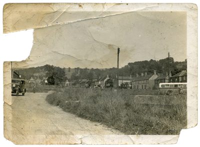
There are at least three items of interest worth looking at in detail.
Detail 1 (from the left of the full image):
There is a car outside the Agricultural Engineers which was owned by W. L. Fisher at the time. It is probably his car (the registration number ends in “8”). Someone is captured in this image, looking towards the photographer.
We recall being told that Mr Fisher was the first person to own a car in the village. Could this be the one?
Detail 2 (from the middle):
In the long grass there are farming contraptions that have been repaired or are awaiting repair (they might even have been made) by Fishers. You can see the metal seats poking up. This was a familiar sight right up until they closed in 1997.
Detail 3 (from the right):
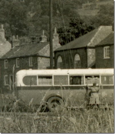
The most evocative image. A woman is on the Everingham’s bus awaiting departure. She is talking to a man through an open window, saying her goodbyes, perhaps?
Bishop Wilton Beacon
Bishop Wilton Beacon was in existence (or remembered) from around 1829 to 1854 because it is marked on maps of those dates. But it had disappeared by 1866 according to J. R. Mortimer who excavated its site.
We were contacted by a former village resident who was eager to find its location on current maps. He was able to flag its position on an aerial photograph that shows a crop discolouration which could mark the remains of numerous beacon conflagrations - see the Bing map and select the Aerial option to see the Satellite Photo.
Alternatively, using Google Earth fly to:
53 59 54.28N, 0 45 47.80W
i.e. copy the characters above into Google Earth’s search box.
Quite apart from the Beacon, this is an interesting area of the parish for pre-historic earthworks which can be spotted on the aerial photographs.
By a surprising coincidence, we have turned up a note to the effect that Wilton Beacon was blown down in a gale in 1863. This comes from the Notebooks of F. C. Heaven which are in the Hull University Archives (Ref: DX/37/3 – soon to be part of a new library in the centre of Hull)